Reading an Old Map Without Treating It as the Whole Place
Reading an old local map carefully helps you spot what it records, what it leaves out and which present-day claims need checking on the ground.
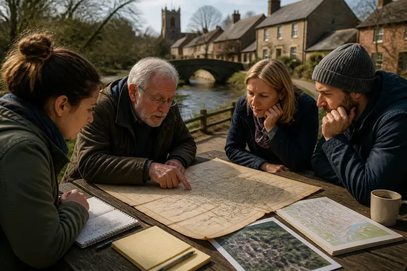
At a local history table, a folded map can draw a finger straight from the old market square to a line labelled “footpath”. Reading an old local map carefully means pausing before treating that line as a complete account of the place now. It records a particular view, made for a particular purpose; the living neighbourhood may have changed around it.
Imagine a clearly hypothetical situation: a residents’ group is discussing a proposed walking route beside a stream. Someone brings an old parish map showing a path between the square and a mill, and the group wonders whether the line represents a route people can use today. The map is useful evidence, but it cannot settle that question by itself.
What was the map made to show?
Begin with the map’s title, marginal notes, legend, scale bar, date and any named creator or issuing body. These details help identify its job. A map prepared to record land ownership, drainage, boundaries or a planned road will emphasise different features from one intended to guide travellers.
Look for clues in what receives the most attention. If parcels have numbers and boundary marks, the sheet may be organised around land units. If roads and junctions dominate, it may be designed to orient a reader. A neat line on a technical plan can show a proposal or surveyed boundary rather than a route open to the public.
In the imagined stream-side discussion, the group checks the heading and sees that the sheet is a parish boundary plan, not a walking map. That does not make the path line irrelevant. It changes the question from “Can we walk there?” to “What feature did the map-maker record as a path, and for what administrative purpose?”
How should you read its symbols and lines?
Do not assume that a familiar-looking mark has the same meaning it would have on a modern map. A double line might distinguish a road from a track; a dotted line could indicate a boundary, a proposed feature or something else entirely. The legend is the first place to check, and notes elsewhere on the sheet may qualify it.
Pay attention to line weight, colour, lettering and the relationship between symbols. A boundary that crosses a path may indicate that the two features serve different purposes. Shading might mark land, relief or an administrative division rather than a built-up area. If the key is missing, record your uncertainty rather than assigning a meaning by guesswork.
Scale also shapes what appears. Small features may be simplified, combined or left off because the sheet cannot show every detail clearly. Think of it like a bus timetable: useful for the information it was designed to carry, but not a complete description of every journey or stop in a town.
For the hypothetical route, the group finds that the map’s key uses the path symbol for a recorded track, but says nothing about public access. That distinction matters. A line can support the claim that a route was marked on the sheet; it cannot, on its own, establish who could use it or whether it remains passable.
What might be missing from the picture?
Every map leaves things out. Its omissions may reflect the subject, the intended reader, the space available or the conventions of its time. A blank patch is not necessarily empty land, and the absence of a building does not show that nobody lived or worked there.
Ask whose activity the map would have needed to record. A property or boundary map may show ownership divisions while saying little about informal paths, gathering places, seasonal work or how residents moved through the area. A map can be accurate for its stated task and still be silent about everyday experience.
In the imagined discussion, the group notices that the stream is drawn but nearby gardens and a cluster of small buildings are not. Rather than claiming that these features never existed, it notes that the sheet’s purpose may not have required them. A second local record, such as a directory, photograph or later plan, could help answer a narrower question about those features.
Omissions deserve particular care when the map is used to support a present-day claim. It may help identify a historic name or suggest where to look next, but it cannot establish current ownership, access rights, building use or the condition of a route. Those questions call for current records and, where access or legal rights are at issue, advice from an appropriate local authority or qualified professional.
How can you compare it with the place today?
Start by finding stable reference points that appear both on the old sheet and on a current map: a church, bridge, stream bend, road junction or public building that has not moved. Use several points rather than relying on one. This helps you see whether the old map has a different orientation, an unusual scale or a distorted reproduction.
Then compare cautiously. A scanned image may have been stretched, cropped or photographed at an angle. The paper itself may have folded or faded, and the map’s original scale may not match the size of the image on a screen. Treat apparent distances as approximate unless you can establish how the copy was produced.
For the hypothetical route, the group compares the old path line with a current council map and a recent aerial view. The stream still bends near the same bridge, but the surrounding road network has changed. The old line ends at land now enclosed by a fence. The group can describe the historical alignment as a lead for further checking, not as evidence that a continuous public route exists today.
If a site visit is appropriate, observe from places you can lawfully access and note what you can actually see: a visible path entrance, a barrier, a sign or a gap in the mapped route. Do not cross a fence or assume that an open-looking track is public. The point of comparison is to separate what the map depicts from what is observable now.
What questions help you read an old local map?
Does a line on an old map prove a public right of way?
No. The line’s meaning depends on the map’s purpose and key, and its presence alone does not establish a present-day access right. For a question about legal status, check relevant current local records and seek qualified advice where needed.
Why does the map leave out buildings I can see in other records?
The map may focus on boundaries, roads or another selected subject, so buildings outside that purpose might be omitted or simplified. Compare records made for different purposes before drawing a conclusion.
Can I compare distances using a digital copy?
Only cautiously, because a scan or photograph may have been resized, skewed or cropped. Look for a scale bar and stable landmarks, and treat measurements from an unverified image as uncertain.
What should I do when the legend is missing?
Describe the mark and its location without naming it as a specific feature. Look for a related edition or catalogue description, then keep any interpretation clearly separate from what the sheet visibly shows.
What should the group say after checking the map?
The imagined residents’ group records its conclusion in two parts. First, it describes what can be seen: the parish plan marks a track between the square and the mill, and the line appears to continue towards the stream. Second, it states what remains unknown: the plan’s purpose does not settle public access, and the current route is interrupted by a boundary that needs checking.
That wording is more useful than either dismissing the map or presenting it as definitive. It preserves a specific historical clue for the next person to investigate, while avoiding a claim the source cannot support. The group can then ask the relevant council team which current access records apply, without implying that the old sheet has already answered the question.
When you read an old local map, keep the evidence, interpretation and unanswered questions distinct. Note the title and date, explain what the symbols appear to mean, identify a significant omission and compare the mapped feature with reliable current information. The map becomes most valuable when you let it point towards the next check rather than asking it to stand in for the whole place.